

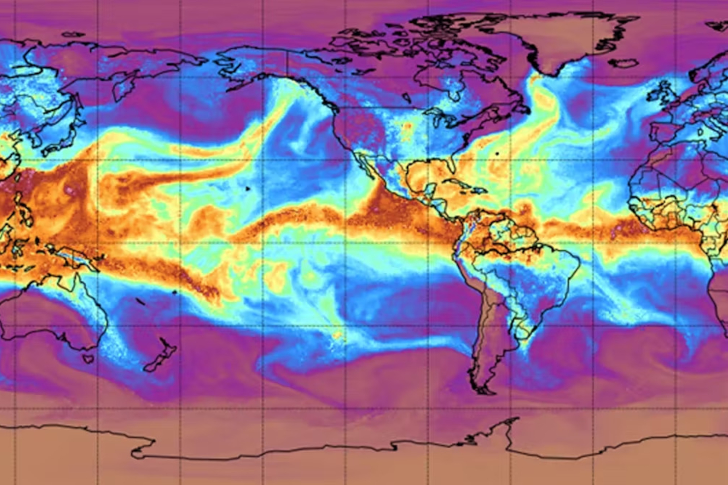
The recent floods in California in January 2023 brought attention to an atmospheric phenomenon of extreme intensity: atmospheric rivers.
These are characterized by very intense moisture flows in the lower atmosphere—that is, in the troposphere (the first 10 kilometers or so of the atmosphere)—which flow in an almost linear fashion, as if they were forced to follow the course of an imaginary river.
Atmospheric rivers are accompanied by strong winds and very heavy rainfall. In California, where they were first described, these torrential rains cause rivers to overflow, and the swell and storm surge exacerbate flooding along coastal areas.
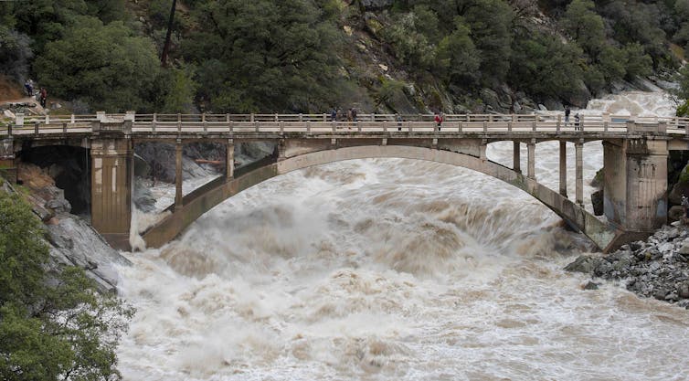
Nevertheless, their impacts are just as severe in Europe. In 2020, the extratropical cyclone Alex moved toward northern France and, to the south, generated an intense flow of water vapor across the Mediterranean from the Strait of Gibraltar to southeastern France and northwestern Italy. This atmospheric river, intensified by evaporation from the Mediterranean Sea and interaction with the terrain, caused torrential rains and devastating flooding in the Italian regions of Liguria and Piedmont on the night of October 2–3, 2020, resulting in the deaths of 15 people.
The cost of the damage caused in Europe and the United States since the 2000s runs into the billions of euros.
Despite this, atmospheric rivers are not a new phenomenon: they are part of the water cycle, and in our latitudes, their effects are fairly well understood. However, our recent research shows that atmospheric rivers also exist in polar regions, where they have a significant impact on the ice cap.
An atmospheric river is a very intense atmospheric flow that typically extends for thousands of kilometers in a “filamentary” shape, like a huge river in the sky.
Because of the shape of the atmospheric river, the flow moves rapidly and concentrates precipitation in a small area (unlike the typical low-pressure systems we hear about on the weather forecast, which are shaped like large “vortices” and tend to “spread out” precipitation over larger areas on the Earth’s surface). The flow of warm, moist air generally rises into the upper troposphere as it moves toward higher latitudes, causing heavy condensation (forming water droplets and snowflakes) and very intense precipitation.
The intensity and pattern of the moisture flow have earned them the metaphorical name “rivers.” It should also be noted that the amount of water transported—in the form of water vapor and droplets— sometimes exceeds the annual flow of even the largest rivers.
Atmospheric rivers can cause severe flooding, as was the case during the torrential rains of January 2023 in California. The authorities appear to have been caught off guard by the severity of the events. Yet similar phenomena had already transformed the (terrestrial) rivers flowing down from the Sierra Nevada into raging torrents that swept everything away.
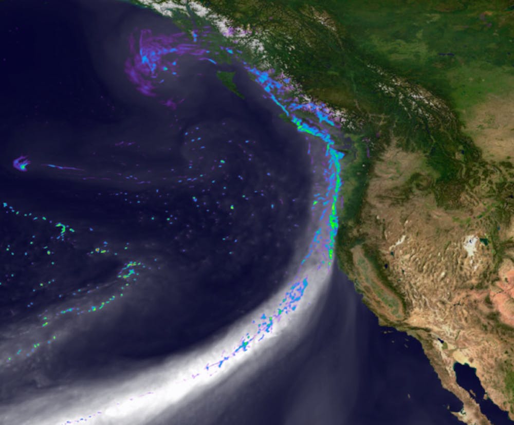
In December 1861–January 1862, over the course of a month and a half, a series of torrential rains transformed the Sacramento Valley into a vast lake measuring 400 kilometers by 30, devastating towns, agriculture, and a quarter of the region’s livestock. However, as dramatic as the massive flood of 1861–1862 may have seemed, a flood of similar magnitude is believed to have occurred approximately every two centuries in this same region.
Atmospheric rivers have therefore always existed; only the term “atmospheric river” is a recent one. They were first studied because of their often catastrophic impact on our societies.
However, not all atmospheric rivers cause widespread destruction. In fact, most of them actually have positive effects on agriculture and ecosystems. For example, they account for 30 to 50 percent of the annual rainfall and snowfall along the west coast of the United States.
They are also a crucial component of the global hydrological cycle. For example, in mid-latitudes, they account for about 90% of the so-called “southern” water vapor transport (from south to north in the Northern Hemisphere and from north to south in the Southern Hemisphere), even though they cover only about 10% of the Earth’s surface. It has also been calculated that four or five atmospheric rivers in each hemisphere may be sufficient to transport the flow of moisture from low to high latitudes around the globe.
[Nearly 80,000 readers rely on The Conversation’s newsletter to better understand the world’s major issues. Subscribe today]
Although research initially focused on our part of the world, it has recently been discovered that atmospheric rivers also affect Antarctica and Greenland, where they are rare but play an even more critical role. Here we describe the effects observed in Antarctica, but their impact in Greenland is similar.
In Antarctica, between two and ten atmospheric rivers reach each region of the continent each year. However, atmospheric rivers are responsible for the heaviest snowfall, thereby controlling the interannual variability and long-term trend in snow accumulation across much of the continent.
However, they have conflicting effects on the “mass balance” of the Antarctic ice sheet—that is, the net balance of snow gains and losses across Antarctica. In fact, air currents of tropical or subtropical origin are also very warm. They thus produce a very strong radiative effect (a form of greenhouse effect) while they are present. This influx of heat is responsible for most of the maximum temperatures on the Peninsula and in West Antarctica.
These high temperatures cause the ice to melt at low elevations on the vast, flat ice sheets trapped in huge bays along the perimeter of Antarctica, known as “ice shelves.”
Melting can contribute to the eventual disintegration of the platforms, but it is not the only process at work. In fact, as the surface melts, the air bubbles in the snow fill with liquid water, which then flows over the surface of the underlying ice, accumulates in lakes, and fills crevasses—a process that helps widen them.
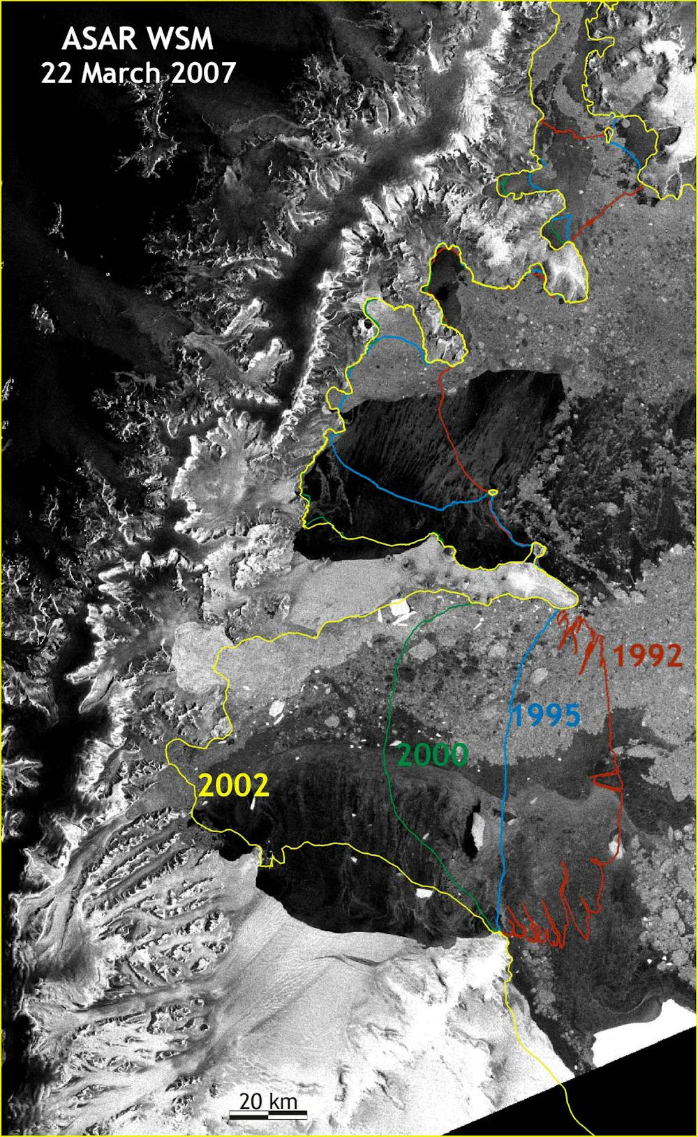
Furthermore, the strong winds associated with the atmospheric river can drive the sea ice (pack ice) in front of the ice shelves out to sea. In the absence of pack ice, ocean swells can reach the ice shelves and destabilize them through flexural movements. This is what happened during the breakup of the Larsen A (late January 1995) and Larsen B (February–March 2002) ice shelves, causing several thousand square kilometers of ice to disappear in just a few days.
Atmospheric rivers therefore have both positive and negative consequences at our latitudes as well as at the poles. Future changes in the intensity of atmospheric rivers will therefore have consequences far beyond California.
How will atmospheric rivers in Antarctica and Greenland evolve in the face of climate change? Is there a risk that the ice in high latitudes will retreat as a result of atmospheric rivers? Answering these questions is the focus of our research conducted as part of the ARCA Project, supported by the National Research Agency.