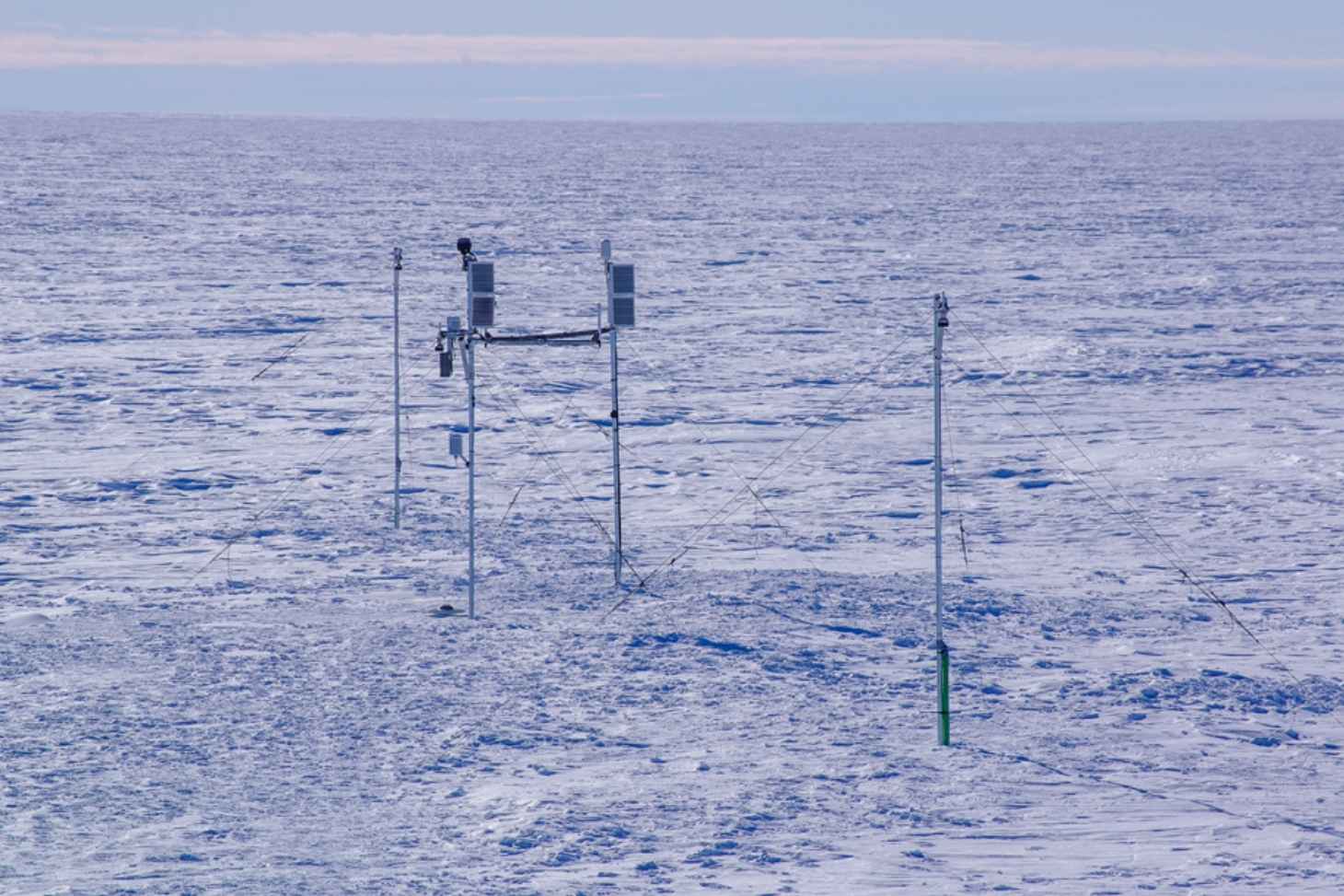
For the first time, reference altimetry stations have been installed in the heart of the Antarctic ice sheet by a team from the Institute of Environmental Geosciences in Grenoble (IGE—CNRS/INRAE/IRD/UGA/Grenoble INP-UGA). This represents a major technological breakthrough that will aid in the calibration of European satellites and our understanding of sea-level rise.
The Institute of Environmental Geosciences has reached a major milestone in the St3TART-FO project, coordinated by NOVELTIS and supported by the European Space Agency (ESA) and the European Commission through the Copernicus program.
For the first time, two reference altimetry stations have been deployed directly on the Antarctic ice sheet. Named premisses01 and premisses02, they provide measurements
in situ with centimeter-level accuracy, which is essential for calibrating and validating data from the Sentinel-3A and Sentinel-3B satellites.
These measures, known as “
Fiducial Reference Measurements " (FRM) represent a very high-quality standard for ensuring the reliability of satellite observations of glacier surface elevation.
An extraordinary scientific and logistical challenge
The installation of these stations is the result of more than a year of preparation, including testing phases in the Alps and extensive logistics to transport the equipment to Antarctica.
In the field, Emmanuel Le Meur, a professor and researcher at UGA, and Arnaud Reboud, a research engineer at UGA, conducted a scientific expedition between December 25, 2025, and January 15, 2026, under extreme conditions marked by particularly strong katabatic winds.
Each station is equipped with ultrasonic sensors that measure snow depth, as well as GNSS systems that accurately track ice movements. They were installed at the following coordinates: premisses01: 137.822°E / 67.719°S and premisses02: 138.745°E / 66.954°S.
Cutting-edge technologies deployed in an extreme environment
In addition to the ground stations, the mission marked a first: the successful completion of drone flights in this polar region, which is otherwise difficult to access due to weather conditions and its proximity to the magnetic pole.
These flights made it possible to collect topographic data essential for creating digital surface models (DSMs), using photogrammetry and an onboard lidar system.
In addition, the team collected independent measurements using a topographic wheel, despite blizzard conditions, in order to validate and refine the observations.
Promising Data for Climate Monitoring
Both stations are now fully operational and are continuously transmitting their data. Once processed, this data will soon be available online in real time.
Initial analyses confirm that the vertical accuracy meets the requirements for FRM measurements, thereby validating the quality of the system. These data will help improve the reliability of satellite altimetry measurements, particularly along the orbits of the Sentinel-3 satellites.
International Cooperation to Address Climate Challenges
This mission exemplifies the success of a collaboration between scientists, engineers, and European institutions. The IGE was able to rely on logistical support from the French Polar Institute Paul-Émile Victor (IPEV), a key player in Antarctic operations.
Ultimately, the data collected will help improve the monitoring of mass loss from the Antarctic ice sheet, a crucial parameter for predicting sea-level rise.
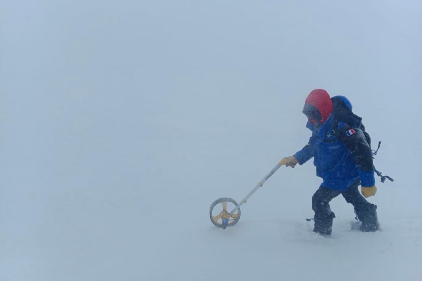
Figure 2: Conducting a topographic survey of the surface using a topographic wheel in blizzard conditions.
The project's scientific team
Vincent Favier, observatory physicist at UGA, IGE
Laurent Arnaud, CNRS research engineer, IGE
Ghislain Picard, professor at UGA, IGE
Emmanuel Le Meur, Associate Professor at UGA, IGE
Arnaud Reboud, UGA Design Engineer, IGE
Lucile Fayon, UGA research engineer, IGE